Monday, March 17, 2014

video: east pass winds


It was windy Monday March 17 in the San Gorgonio Pass, with winds out of the west between noon and sundown, and dust storms visible south of Whitewater Canyon.

The National Weather Service predicted a 180-degree shift in wind direction for Monday night through Wednesday.

Pressure building over the Great Basin was expected to generate offshore winds late Monday through Wednesday afternoon, according to the Weather Service. Northeast to east winds 15 to 30 miles per hour with gusts to 45 mph were expected for passes and canyons Tuesday.

Video by Guy McCarthy

Tuesday, March 11, 2014

update: northeast winds prompt red flag warnings


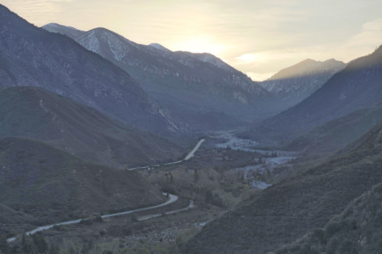
Looking east up Mill Creek Canyon: 7 a.m. March 11 2014 by Guy McCarthy

By Guy McCarthy

Update 4:19 p.m. The National Weather Service has upgraded a fire weather watch for inland foothill, mountain and desert communities to a red flag warning "for strong gusty winds and low humidities" from 6 a.m. to 6 p.m. Wednesday March 12. 

Posted 1:14 p.m. Dry winds out of the northeast are forecast for late Tuesday through Wednesday evening, and a fire weather watch has been issued for an area including the Mountain Top, Front Country and San Jacinto ranger districts in the San Bernardino National Forest.

Red flag warnings were issued further west in L.A. and Ventura counties, where sustained winds to 40 miles per hour and gusts to 65 mph are possible in areas including the Hollywood Hills and Malibu, according to the National Weather Service.

Wind advisories for the Inland Empire and Coachella Valley are posted for 11 p.m. March 11 to 6 p.m. March 12, with north to northeast winds of 20 to 35 mph possible. Gusts to 65 mph may occur in some foothill areas.

In spite of heavy rains less than two weeks ago, daytime humidity levels could drop to 10 percent in some areas, and "critical fire weather conditions are forecast to occur," the Weather Service warned.

Sunlight on Mill Creek Jumpoff: 7:30 a.m. March 11 2014 by Guy McCarthy
 
Increased fire risks are a concern across parched Southern California, where the cities of Riverside and Los Angeles experienced their driest calendar years on record in 2013.

Concern is also evident in towns along Mill Creek. Eight years ago, the Mill Creek Canyon Fire Safe Council issued a report for Mountain Home Village and Forest Falls stating historical data from 1900 to 2004 shows large fires have never occurred in the densely forested, easternmost areas of Mill Creek Canyon. Numerous fires have occurred in the west end of the canyon and on Yucaipa Ridge.

'San Bernardino County Supervisors, Circa 1914' restored by Fred Flyfisher Fotos

On a more upbeat note, residents of Mountain Home Village are preparing to celebrate a century of local history later this month. Organizers are using the photo above to promote their event. Historians say it shows county elected officials a hundred years ago at the opening of the "Middle Control Road" on the way to Big Bear.

The celebration is scheduled Saturday March 22 and includes a mountain bike ride at 8 a.m., walking tours at Loch Leven, and a 2 p.m. presentation about Mountain Home Village and the Lower Control Road by historian Tom Atchley.

Loch Leven is at 8171 Mountain Home Creek Road, about three miles past Mill Creek Ranger Station. For more info call Sloan at (909) 794-2507 or Carol at (909) 794-6713.

Thursday, March 6, 2014

recent storm 'no drought buster'


Click to View Large

Storms last week and through the past weekend brought badly needed rain and snow to California but they did little to affect the ongoing statewide drought, climatologists at the National Drought Mitigation Center and Caltech's NASA Jet Propulsion Lab in La CaƱada said in phone interviews.

"The big picture for California is the rain is welcome, but realistically the drought did not change from that one single precipitation event," Bill Fuchs with the U.S. Drought Monitor said Thursday March 6. "It brought some relief but it did not do a whole lot to change the overall situation."

The National Drought Mitigation Center is a federal partnership that includes the University of Nebraska, NOAA and the USDA. The drought in California is long-term and the recent rains were not enough to make a significant difference, Bill Patzert at JPL said.

"We had improvement," Patzert said. "Los Angeles was 10 percent of normal and now it's around 49 percent. So does that put a dent in the drought? Statistically speaking it did. But the reality is when you get that much water that rapidly it's like somebody shooting a fire hose and trying to catch it in a champagne glass.

"We've engineered So Cal 80 so that 90 percent of that rain water ends up in the ocean," Patzert said. "Statistically it looked like we went from 10 to 50 percent of normal but it came so fast we didn't catch it. We're not engineered to catch it, we're engineered to move the water to the ocean because we concrete lined all the rivers."

Here's a rundown of the storm from the National Drought Mitigation Center published March 6:

A blockbuster storm struck California as the calendar turned from February to March, averting a record-breaking season for dryness. From February 26 – March 2, the potent storm - and a weaker, initial system - accounted for more than 75 percent of the season-to-date precipitation in California locations such as Burbank (4.78 of 5.28 inches); downtown Los Angeles (4.52 of 5.72 inches); Camarillo (3.66 of 4.85 inches); and Sandberg (3.04 of 3.93 inches). However, after the precipitation ended, season-to-date (July 1 – March 4) totals were just 40 percent of normal in Burbank, Camarillo, and Sandberg, and 49 percent of normal in downtown Los Angeles.

At the height of the second storm, on February 28, Los Angeles - with 2.24 inches - experienced its wettest day since March 20, 2011. Los Angeles also received at least an inch of rain on 3 consecutive days (February 27 – March 1) for the first time since December 18-20, 2010. Benefits from the storms extended northward along the California coast and into some northern areas of the state, leading to a modest reduction in the coverage of extreme to exceptional drought (D3 to D4). However, short-term benefits from the storms were mostly offset by still-large, 3-year precipitation deficits, low reservoir levels, and a sub-par snowpack.

The California Department of Water Sources reported a slight jump in the water equivalency of the high-elevation Sierra Nevada snowpack. The water content, which averaged just 5 inches (22 percent of the late-February normal) prior to the two storms, climbed to 8 inches (33 percent) by March 5. The snowfall was heaviest in the southern Sierra Nevada, where a slight reduction in the coverage of extreme to exceptional drought (D3 to D4) resulted.

Storm water, mud and debris behind San Gabriel Dam: March 4 2014

The drought over the past 15 years has waxed and waned since 1999, Patzert said. During the past 30 years the demand for water has dramatically increased, for agriculture, new housing, suburban uses, and at the same time the population of California has quadrupled.

"Demand is up and over the last 15 years the supply is down," Patzert said. "You get a big storm and Mother Nature gets your hopes up but then it doesn't rain for another five or six months. Maybe we get another five years of this. If you look at the history of California it's written in droughts and they tend to be long. There's no quick fix for a drought.

"Everybody started hyperventilating about this storm last week," Patzert said. "It wasn't record breaking. This was an average storm. We hadn't seen one in such a long time, but it's no drought buster."

For background see:

How Dry was 2013? Cities of Riverside and L.A. Had Driest Calendar Years on Record

Photo by Guy McCarthy

-30-

Tuesday, March 4, 2014

storm waters captured but dams not near full


Stormwater behind Morris Dam: 7:15 a.m. March 4 2014

By Guy McCarthy

Update 4:23 p.m. Whatever volume estimates the Department of Public Works comes up with for storm water capture since the recent rains, the levels behind Morris Dam and San Gabriel Dam today look the same or lower than Feb. 11 and Feb. 18, when Los Angeles Times photographer Don Bartletti visited.

Click here to view and see if you can spot a difference. What do you think?

Posted 1:48 p.m. Low clouds loomed over Glendora and Azusa early Tuesday, but the rising sun broke through fog further up in the mountains, glinting off stormwater captured behind dams on the San Gabriel River.

Some locations in the San Gabriel Mountains received more than 10 inches of rain during the recent storms, according to the National Weather Service. But the reservoirs above Azusa were not nearly full.

Instruments at Morris Dam north of Azusa on the San Gabriel River, measured 5.19 inches between Wednesday evening and early Monday, and further up the drainage San Gabriel Dam got 8.50 inches, according to a precipitation summary published at 5 a.m. March 3.

Further east in the San Bernardino Mountains, 11.11 inches of rain fell on Yucaipa Ridge from Thursday to Sunday, according to the Weather Service.

Whether the recent rains had significant impact on the current drought is open to speculation and debate. Regardless of the drought, something is better than nothing.

"Before these recent rains all the county's reservoirs were at minimum pool," Kerjon Lee of the L. A. County Department of Public Works said Tuesday in a phone interview. "That means in the cases of Morris and the others there was just enough water to protect  the valves for controlled release of water."

Stormwater behind Morris Dam looked a steely gray-green in the morning sun. Further up canyon behind San Gabriel Dam mud, debris and sediment were evident in the brown mix.

Behind San Gabriel Dam: 8:40 a.m. March 4 2014

Erosion and accelerated sedimentation are a concern for the Department of Public Works, which has been responsible for the Morris and San Gabriel dams and reservoirs since 1995. They were both built in the 1930s for dual purposes: flood control and water conservation.

The Morris Fire in August 2009 scorched watersheds that drained into portions of both reservoirs, but the Colby Fire burn above Glendora and Azusa does not appear to impact either reservoir.

Other dams, including Devil's Gate, Pacoima and Tujunga, still require cleaning out from the massive September 2009 Station Fire, Lee said Tuesday.

On Ridge View Drive in Azusa: 9:15 a.m. March 4 2014

Out on the mountain front in Azusa, residents, volunteers and others were at work removing mud from a yard behind a home on Ridge View Drive, near the west edge of the 1,950-acre Colby burn.

K-rail and sandbags remained in place on many residential streets in Glendora, where utility crews and other workers continued storm cleanup.

Photos by Guy McCarthy

-30-

Sunday, March 2, 2014

coroner IDs girl fatally injured


By Guy McCarthy

The coroner has identified a girl who was caught between two vehicles and fatally injured Saturday on Valley of the Falls Drive, where she and her family had parked below the Big Falls parking lot to play in fresh fallen snow.

Marissa Trujillo, 7, of San Bernardino, was with her family and their pickup was parked at the side of the road when an oncoming vehicle struck the pickup shortly after 2:40 p.m. March 1, coroner's personnel said in a statement.

"Marissa and other family members standing outside the pick-up sustained serious injuries when caught between the vehicles," the statement said.

The injured were taken to Loma Linda University Medical Center's emergency room, where Marissa was pronounced dead at 3:48 p.m., according to the coroner.

Distraught family members remained near the crash Saturday afternoon and prayed, a member of emergency personnel at the scene told Watershed News.

The crash was being investigated by the California Highway Patrol. Two vehicles were taken for evidence.

Click here to read Saturday's report from Watershed News.

-30-

Saturday, March 1, 2014

mill creek


Mill Creek under Highway 38: March 1 2014

By Guy McCarthy

Welcome back to Watershed News. I let the site go dormant the past three years I was at Patch. If this is your first visit, thanks for checking in.

Yesterday I saw a video of storm runoff in Mill Creek roaring through the narrows under the SR 38 bridge below Mountain Home Village.

The National Weather Service estimates 8.58 inches of rain hit Yucaipa Ridge during a 24-hour period that ended at 9 p.m. Feb. 28.


The place under the bridge looked and sounded a lot different today. It was still raining a bit, enough to soak me, but it was quiet and peaceful compared to Friday.

Further up Mill Creek it was snowing in Forest Falls.


Elkhorn General Store has a sign outside stating "Elevation 6,000 ft." Two residents went into the store and one of them had a chihuahua mix wrapped in a blanket.


I spoke briefly just before 2 p.m. with two volunteers with San Gorgonio Search and Rescue, who said the day had been quiet so far. 


Back down Mill Creek, below the bridge and near Fish Hatchery in east Mentone, a silver 4-door Jeep 4x4 with a New York plate visible on the rear was still stuck in the wash at 2:40 p.m. The California Highway Patrol reported discovery of the unoccupied vehicle Friday evening. There was no sign Saturday of whoever left it there.

Right around the same time, the Highway Patrol reported an incident involving two vehicles near the end of Valley of the Falls Drive. Fire rescue personnel were called and responders were advised of the need for a landing zone.

By 6:30 p.m. this evening, the CHP had labeled the incident a fatality, and two vehicles had been taken for evidence.

One of the emergency personnel who responded to the incident said two pickup trucks collided about 100 feet west of the rangers kiosk at the Big Falls parking lot.

One victim, a girl who appeared to be between 9 and 12 years old, was taken to a helicopter at the LZ set up further down Mill Creek, below Forest Falls and east of the 38 junction.

She was believed to be in critical condition as she was airlifted by a Sheriff's Aviation crew to a hospital. Another injured victim, an adult female, was taken by ground ambulance to a hospital for treatment.

Firefighters from Forest Falls and Angelus Oaks, AMR personnel, and the San G SAR team were among those who responded.

Distraught family members, who had come to Forest Falls to play in the snow, remained near the crash scene and prayed.

Photos by Guy McCarthy

-30-

Sunday, January 9, 2011

busy baldy


Sunday climbers take direct route up San Antonio

By Guy McCarthy

MOUNT BALDY - Valleys and foothills of east Los Angeles County were socked in under a cold blanket of cloud much of Sunday, but above Baldy Village it was clear and warm.

Snows high on sun-drenched Mount Baldy drew scores of backcountry skiers and snowboarders, and squads of hikers equipped with ice axes and crampons climbed the steep, direct route to L.A. County's highest point.


Cloud cover viewed from above Baldy Village Sunday morning

Thousands more visitors drove up to San Antonio Canyon by the afternoon, packing parking areas above 5,000 feet elevation and briefly blocking emergency responders when a woman suffered a head injury in a possible sledding accident, according to the U.S. Forest Service.

By 2 p.m. two people had been treated for snow-related injuries and an estimated 4,000 people and their vehicles were between Baldy Village and the Mt. Baldy ski lift, Forest Ranger Mike Testa told Watershed News.

Testa said it was "a beautiful day" and he advised people to "be careful in the rocks and snow."

Search-and-rescue volunteers responded and fire engine drivers sounded their horns to get through traffic on upper Mount Baldy Road to reach one of the injured.


Rescuers on Mount Baldy Road while a woman is bandaged Sunday

It was so crowded by 2:30 p.m. authorities were stopping traffic near the Baldy Trout Pools, and a line of eager motorists a mile long stretched downhill through Baldy Village.


Traffic outside Mt. Baldy Lodge restaurant Sunday afternoon

Photos by Guy McCarthy